Géorisques et Environnement -
Département de Géologie - Université de Liège
NATO Science for Peace and Security Project LADATSHA 2008-2012
Prevention of Landslide Dam Disasters in the Tien Shan, Kyrgyz Republic

Project Directors:
Partner Country: Torgoev, Isakbek; Bishkek, Kyrgyz Republic
Nato Country: Havenith, Hans-Balder; Liege, Belgium
Project summary
River-blocking mass movements should be considered as one of the most hazardous natural phenomena in mountainous regions. Besides the direct effects on the communities and infrastructure, landslides could have even more disastrous secondary and tertiary effects – upstream inundation and subsequent outburst floods in case of dam failure. Numerous case studies were described during the NATA ARW "Security of Natural and Artificial Rockslide Dams" in 2004, among them the most disastrous mass movement catastrophe ever reported – failure of the earthquake-triggered Dadu rockslide dam in 1786 in China that killed about 100000 people downstream. Numerous modern and past dams formed by mass movements are known in the Central Asian region, including the 1911 Usoi blockage (triggered by the Ms=7.4 Sarez earthquake) that formed 500 m deep Lake Sarez containing about 17 km3 of water. Several lakes, fortunately not so large, were breached in XXth century – the Issyk Lake near Almaty city in Kazakhstan in 1963 and the Yashinkul Lake in southern Kyrgyzstan in early 60th. At the same time some rockslide dams demonstrate extreme longevity such as the Beshkiol dam that have existed for about 3000 years until it was almost completely infilled by sediments and, finally, was bypassed by the Naryn River.
Our goal is to prevent major disasters related to dams and flood waves generated by mass movements in the Tien Shan of the Kyrgyz Republic.
This will be achieved through
- Detailed regional and local investigation of existing and potential landslide dams and unstable slopes in areas of strategic interest: present and planned water reservoirs, nuclear waste storage areas;
- Numerical modelling of process sequences of (seismic) landslide triggering, dam formation, and flooding, also as a result of landslides falling into a water reservoir;
- Advanced 3D representation of hazard and qualitative risk scenarios considering short- and long-term socio-economic and environmental impacts.
Disaster prevention measures will be elaborated in close collaboration with the Ministry of Emergency Situations of the Kyrgyz Republic and experts of the neighbouring countries Kazakhstan, Uzbekistan, Tajikistan and China.
Project Director Teams:
Dr. Torgoev, Isakbek Director of Scientific- Engineering Center GEOPRIBOR, Institute of Geomechanics and development of Subsoil. Academia of Sciences of the Kyrgyz Republic. Mederova str., 98, 720035 Bishkek, Kyrgyz Republic. tel/fax: +996 312 541131; email: geopribor@mail.ru
Torgoev, Almazbek – PhD student PhD student at SEC GEOPRIBOR - torgoeval@yahoo.com
Dr. Havenith, Hans-Balder
Chair of Géorisques et Environnement, Dep. of Geology - B18, University of Liege, B-4000 Liege, Belgium
tel: +32 4 3669316; fax: +32 4 3662029; email: HB.Havenith@ulg.ac.be
Project Co-Director Teams:
Prof. Abdrakhmatov, Kanatbek
Director of the Kyrgyz Seismological Institute, Academy of Sciences of the Kyrgyz Republic. Asanbay str., 52/1, 720060 Bishkek, Kyrgyz Republic
tel: 00996 312 523826 ; fax: +996 312 666334; email: kanab53@rambler.ru
Achakeev Eldiar – PhD student PhD student of the Kyrgyz Seismological Institute.
Mr. Kasymbek uulu Shailoo
Deputy Director of the Department of Emergencies Monitoring and Forecasting and Mining Tailing Maintenance, Minister of Emergency Situations of the Kyrgyz Republic. tel:+996 312 614743; fax: +996 312 614752; e-mail : dhmp-piu@ktnet.kg
Kanat Karybai uluu - Assistant, Ministry of Emergencies Situations of the Kyrgyz Republic
Dr. Strom, Alexander
Senior Researcher, Institute of the Geospheres Dynamics, Russian Academy of Sciences, Leninskiy Avenue, 38, Building 1, 119334, Moscow, Russian Federation, tel: +7 495 9397980; fax: +7 495 1376511; email: a_strom2002@yahoo.co.uk
Dr. Korup, Oliver
Institut für Erd- und Umweltwissenschaften, Universität Potsdam, D-14476 Potsdam, Germany. +49-331-977- 5811. korup@geo.uni-potsdam.de
Dr. Miriam Kristeková
Head of the Seismology Department, Geophysical Institute, Slovak Academy of Sciences, Dubravska cesta 9, SK-845 28 Bratislava 45, Slovak Republictel: +421 2 59410608/11; fax: +421 2 59410626; email: kristekova@savba.sk
Targets
Target 1- existing rockslide dams and hydropower projects
The Kambarata-2 Project is currently under construction. It includes a 60 m high blast-fill dam that will be constructed using about 2700 tons of explosives. Its 50 m deep and 9 km long reservoir is located in the tectonically active and landslide-prone zone. The Kambarata-1 Project is now at the feasibility stage. HPP in the Kokomeren River valley were designed just before collapse of the US Dollars.
Target 2 – landslide dams in nuclear waste storage areas
The nuclear waste storage areas of Minkush and Mailuu-Suu (location in figure 1) are now experiencing the (probably) highest risk related to landslides forming dams in the Kyrgyz Republic. Recent mass movements and dam failures have already caused moderate damage, but failures expected for the near future are likely to cause real ecological and social disasters: in both areas, there is high probability that major nuclear waste tailings will be inundated by lakes upstream of dams formed by active landslides. Previous projects focused on problems related to the presence of the nuclear waste tailings, but neglected the potentially adverse impacts of geological hazards.
Upstream of the nuclear waste storage area of Mailuu-Suu, the possible failure of the prehistoric rockslide dam Kutman-Kul poses an additional threat. Downstream inundation and destabilisation of nuclear waste tailings are real dangers.
The project focuses on the following questions:
- Where are the dams?
- What is their present stability?
- What would be the consequences of large rockslides for the future Kambarata 1 and 2 (possibly also Kokomeren) Reservoirs? Is the damming of the rivers in Mailuu-Suu and Minkush by mass movements imminent? ... What is the worst-case scenario
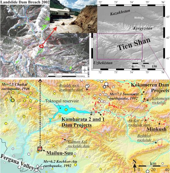
Targets of the project in the Kyrgyz TS: planned/ongoing Kambarata and Kokomeren HPP projects, Belaldy rock avalanche, Ak-Kul and Kutman-Kul rockslide dams, giant Kokomeren and Beshkiol rockslides and Minkush and Mailuu-Suu nuclear waste storage areas. Landslides mapped in detail are outlined in red, recorded earthquakes (4<Ms<8) are marked by filled circles (yellow: before 1980; white: since 1980).
Upper left figure: Quickbird image (60 cm ground-resolution) of the central part of the Mailuu-Suu Valley with overlay of landslides (red outlines), rivers (blue) and nuclear waste tailings (filled green); photograph of Tektonik landslide dam breach in spring 2002.
Photos
NATO SFP LADATSHA - Kick-off meeting March 2009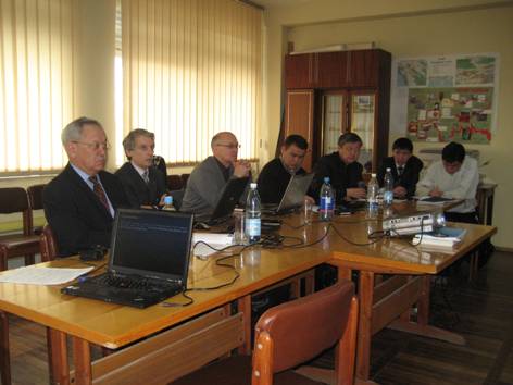
From left to right: I. Torgoev (GEOPRIBOR, KR), A. Strom (IGD, Russia), Anatoli Ishuk (from Tajik Institute of Earthquake Engineering and Seismology), Talantbek Aldashov (ACTED organization KR– end-user); Representatives of Department of Monitoring and Forecast of the Ministry of Emergency Situations (KR): A. Aitaliev, D. Sakyev, K. Karybaiuulu.
NATO SFP LADATSHA Field surveys
Kamabrata 2 blast-fill dam - December 2009
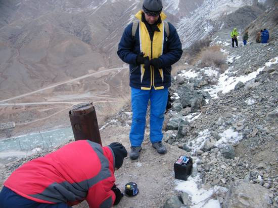
Installation of accelerometers by Slovak partners close to the blasting site: Erik Bystricky, Andrej Cipciar.
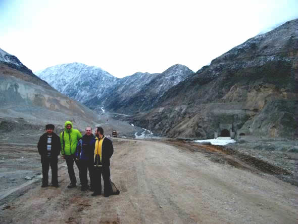
LATATSHA participants in front of the new blast-fill dam and tunnel.
Minkush survey - summer 2011
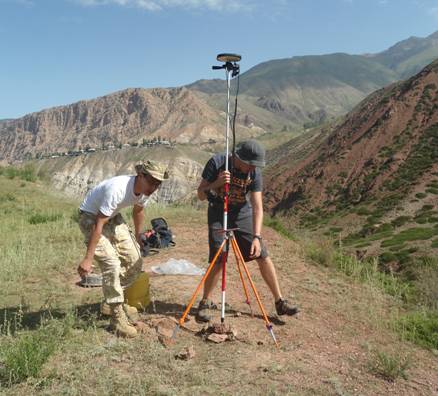
Installation of DGPS reference station by Almaz Torgoev and Stephan Burette.
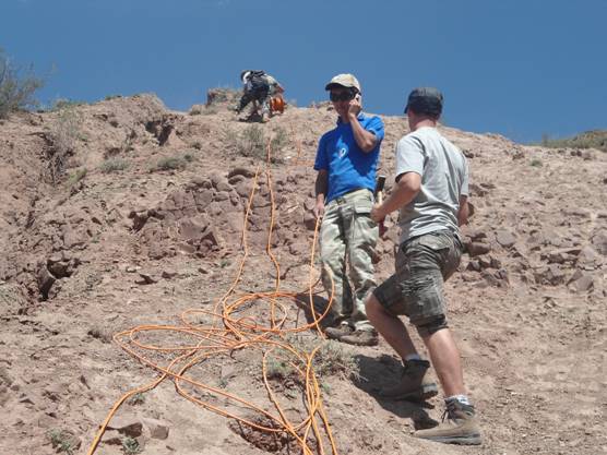
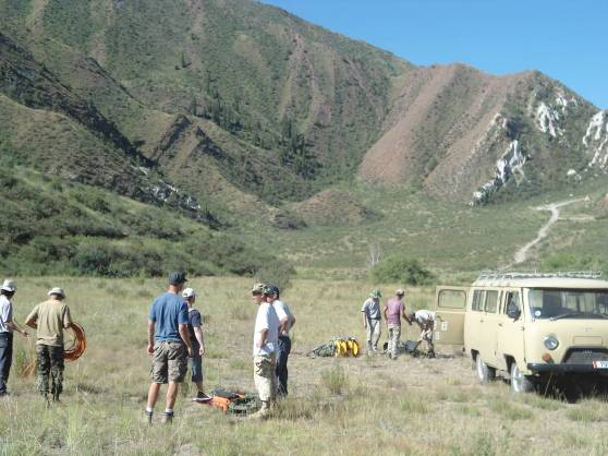
Eldiyar Achakeev and Romain Deprez spreading cables for a geoelectric profile on Tuyuk-Suu landslide.
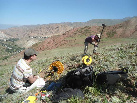
Eldiyar Achakeev and Hans-Balder Havenith doing seismic refraction on Tuyuk-Suu landslide.
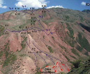
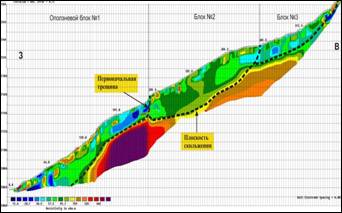
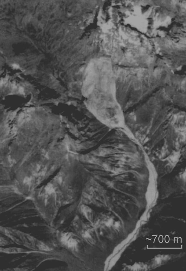
View (to SE) of Tuyuk Suu landslide and location fractures (blue dotted lines), markers (R1-23) and the main 700 m long geoelectric profile (between marker R15, R12 and red scarp below). Main 700 m long geoelectric profile with landslide blocks marked by dashed lines.
Geophysical survey on Taldy-Bulak tailing.
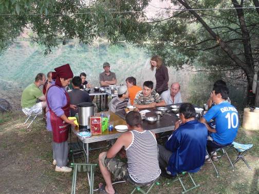
Lunch in the Ak-Kul field camp.
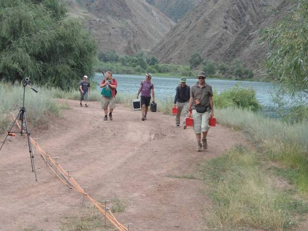
...before carrying batteries, seismometers, cables.
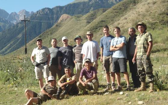
Kyrgyz, Slovak, Belgian participants of the Minkush survey.